Preparations
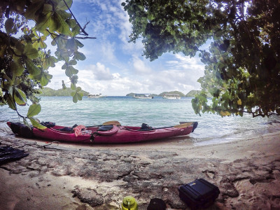
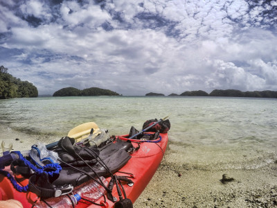
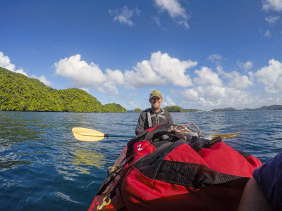
From the United States, we brought our own camping and paddling equipment. The only thing we did not bring was the kayak itself, which we rented from a company called Paddling Palau. Paddling Palau is associated with Sam’s Tours, a diving operation near Koror. The boat we rented was a plastic, two-person touring kayak with rudder.
The evening before we got on the water, Jene of Paddling Palau came by our hotel room with a guide, Jake. They gave us a printed itinerary; a two-hour briefing; and the loan of waterproof maps showing campsites, snorkeling spots, and points of interest.
Day 1: German Lighthouse, Fantasy Lake, and Peninsula Camp
A different Sam’s Tours guide came to our hotel at 07:45 in the morning. He took us to the boat ramp near the Ranger office on the island of Malakal, where the kayak was waiting on a trailer. We loaded the boat, launched, and pointed our bow toward the German Lighthouse. A stiff, quartering wind made for tough paddling.
Four nautical miles later, we landed at the remains of a pier. An unkept trail led from here to the lighthouse. We walked a couple hundred meters, Jen saw a big millipede cross her path, and that was the end of that.
Back in the boat, we paddled to and around Fantasy Lake. We saw nothing of great interest here.
Next was Woodswallow Bay, where we looked for dugongs and crocodiles. We saw none.
Now we retraced our path, back toward Koror and Malakal Island; and from there paddled another six nautical miles to our planned stay at Peninsula Camp. The wind swirled around the islands and islets, and down the channels between them, constantly changing directions, and always seeming against us. The paddling was long and painful.
We wanted it to end; so we gave up on our plans to snorkel along the way. We just kept paddling, our heads down, ignoring what we passed. We reached the camp at 2:30 in the afternoon, tired and sore, and having paddled a total of 14 nautical miles.
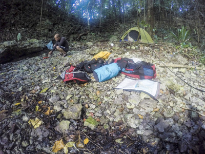
Peninsula Camp sits on tiny cove with a stone beach, surrounded and overhung by vegetation. The camp’s only attraction is the lack of an alternative for another nine nautical miles. Its principal tent site is located uphill of the cove; it was hard to reach, and we were concerned about the dirt floor turning to mud if it rained. There is a smaller tent site near the waterline, with a floor of jagged rocks. We opted for this spot, and used tarps and mats to soften the rocks.
We set camp, made dinner, drank some warm beer, and were in the tent by dark. Fish splashed throughout the night. Patches of rain passed. It was hot and humid, and no breeze reached the cove. We slept naked, uncovered, and sweating.
Day 2: Lost Lake, Natural Arch, Soft Coral Arches, a Sand Beach, and the Ngchus Campsite
In the morning, we woke to the sounds of birds in the trees and bushes around the cove.
After breakfast, we began paddling nine nautical miles to the Ngchus campsite. Our path took us southwest through the cluster of islets lying west of Ngeruktabel Island, through Little Channel, and then southeast along Ngeruktabel’s southwestern shore.
We stopped at a few places along the way. The first was Lost Lake, which is really the size of a medium pond. The lake’s entrance is a narrow opening through the rock wall of an islet, which is only exposed at low tide and just big enough to pass a kayak. We arrived at the right time, got ourselves inside, and found there wasn’t much to it, other than the novelty of getting there.
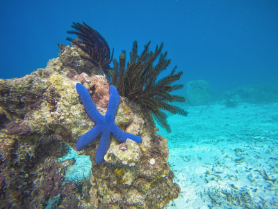
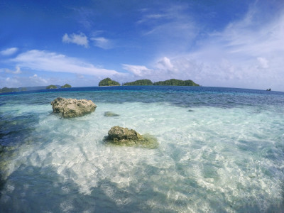
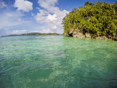
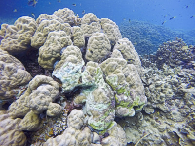
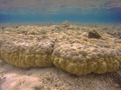
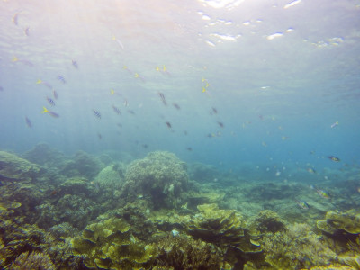
The next stop was in the lee of a small islet, where we gave our rear-ends a much-needed rest from the kayak’s hard, plastic seats. We snorkeled at this randomly-selected spot, expecting nothing, but finding a superb display of fish and coral. Anywhere else in the world, this would be a well-known dive site. But in Palau, where stunning underwater scenes are commonplace, it goes without name or notice.
Paddling onward, a reef shark passed close-by and under the boat.
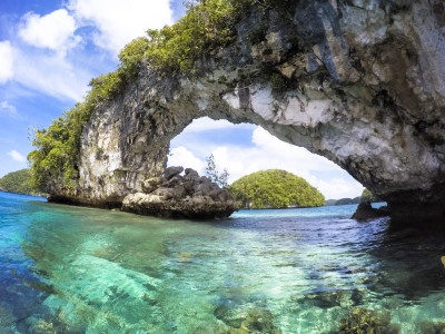
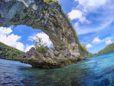
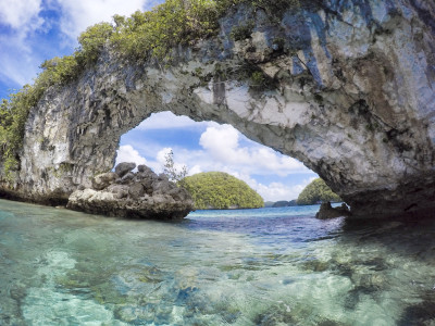
At Natural Arch, Jen took photographs and we ate snack bars. The arch is featured in many tourism advertisements, and was part of the opening scenes for a season of the reality game show, Survivor.
From Natural Arch, we paddled to Soft Coral Arches. Here there is a small passage through the coral wall of an islet, on one side of which are moorings for tour boats, and on the other side of which is a large cove of calm, protected water. In the water of the passage, there is a species of soft coral. We paddled through the passage, around the cove on the far side, back through, and then onward to Little Channel.
Little Channel is a narrow pass between Ngeruktabel and Ngededangel Islands. It is heavily used by shallow-draft tourist boats. There are about two nautical miles of open water northeast of the channel, between it and Ngebedel Island. This gave enough fetch to the wind that the open water became choppy and challenging. Inside the channel, the wind increased significantly and the waves were confused. For about 200 meters, it was hard work to get through without capsizing or broaching.
On the immediate southwestern side of Little Channel, on the tip of Ngeruktabel Island, is the entrance to a very large cave with resident bats. We stopped here to take a break and explore.
Continuing our paddle to the Ngchus campsite, we stopped at a small sand beach about mid-way between it and Little Channel. This was the first no-kidding, sand beach we had seen in two days. We had a snack and a swim.
Finally, we arrived at Ngchus. The campsite is located in a cove at the southernmost end of Ngeruktabel Island. A German couple had arrived a few minutes before us and was making camp under one of the shelters. This was the only night we shared a campsite.
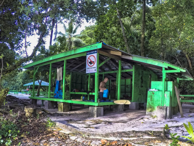
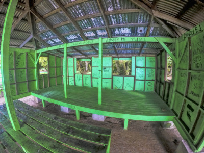
Ngchus is a developed campsite, with features common to all the developed campsites we saw in Palau’s southern lagoon. It has two wooden shelters that are well-constructed, open-sided, covered with metal roofs, and outfitted with cooking pits. One shelter has a large, wooden platform that is suitable for a tent, which is the shelter we used. The other shelter has no platform, but is the right size and construction for hanging hammocks, as demonstrated by the German couple. The campsite also has two composting toilets, picnic tables, and bench seats. There is nowhere to dispose of garbage, which must be carried out. Fishing is prohibited in the immediate area of the campsite and its beaches.
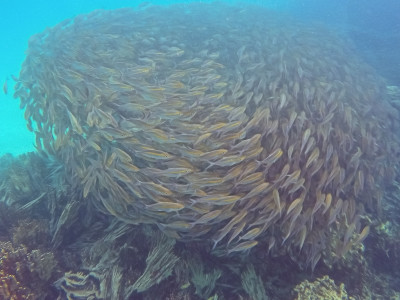
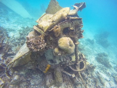
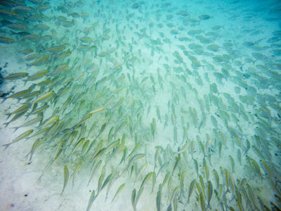
We made camp and went snorkeling in the cove. It is a respectable spot, with moderate visibility, some old coral, and a fair amount of fish. Our map indicated a Second World War Japanese airplane submerged in the northern part of the cove; we looked, but didn’t find it this day. We spent much of the snorkel in and around a large ball of bait fish.
As evening came, we ate and watched wildlife. Schools of bait fish raced along the water’s surface, under attack from larger fish and birds. The fin of a shark passed along the beach. Large fruit bats flew overhead. Feral chickens rummaged in the brush behind our shelter.
At night, the cove became quiet and calm, with an occasional heavy rainfall from a passing cloud. The shelter, however, was not quiet. An overhanging tree dropped several golfball-sized nuts onto the metal roof, waking us several times.
Day 3: Jellyfish Lake, Giant Clam Beach, and Back to the Ngchus Campsite
The plan for this day was to snorkel Jellyfish Lake, known for its population of non-stinging jellyfish.
Jene and Jake from Paddling Palau had advised us to arrive early, before the flood of tour boats; so we woke early, ate, broke camp, packed the boat, and were paddling by 7:00 in the morning. 90 minutes later, we arrived at the floating dock for Jellyfish Lake. We were the day’s first arrivals.
Near the dock is a ranger station, where our Jellyfish Lake permits were checked. From here, we walked the trail that ascends and descends a ridge between the dock and the lake.
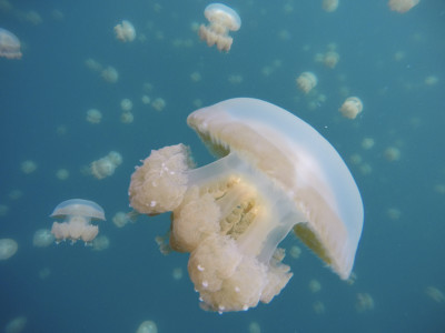
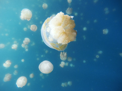
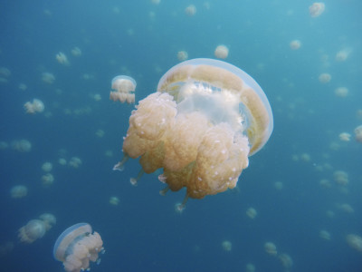
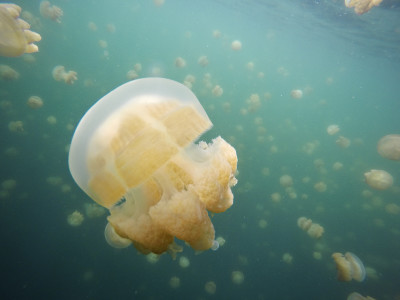
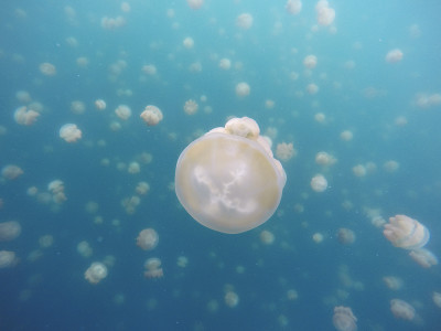
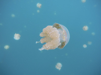
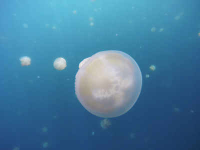
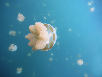
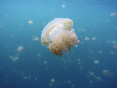
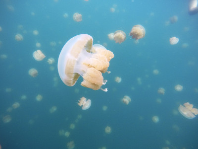
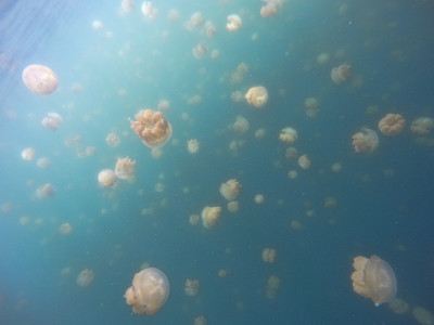
Jellyfish Lake is larger than we expected (we expected a pond with the title “Lake”). Floating platforms were anchored on its shore, near the end of the trail. We walked onto a platform, donned masks and fins, and lowered ourselves into the water. About fifty meters from shore, we began seeing a few, scattered jellyfish. Being cynical travelers, we figured this was as good as it would get. We were wrong. A short distance later, we swam into a dense wall of thousands of jellyfish. Jellyfish Lake is one of those rare places where reality matches the hype.
Swimming through thick clouds of jellyfish was a unique experience. We would stop to watch an individual jellyfish pulse through the water, and then jump with surprise when other jellyfish brushed across our legs. We would swim underwater though the mass, feeling slick-rubbery jellyfish slide along our skin. Through our snorkels, we alternated between squeals and laughter. It was creepy, and it was fun.
Eventually, groups of tourists arrived at the lake. Designer wetsuits, underwater cameras, bright-yellow flotation devices, the excessive splashing of inexperienced snorkelers — these were our signals to leave. Back at the ranger station, the dock was thick with boats and people. We carved out enough space to repack the kayak, got in, and paddled away. The advice to arrive early was good.
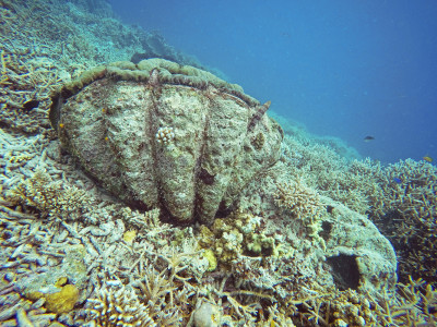
Our next landing was Euidelchol Island, home to Giant Clam Beach. This spot has a concentration of giant clams in shallow water. It was a worthwhile snorkeling experience.
Euidelchol Island has a developed campsite. When we arrived at Euidelchol, a tour company’s cooks were there, preparing a group lunch.
After snorkeling, we sat on the beach, ate, drank some rum, and watched the tourists arrive for their lunch break. At one point, we counted six tour boats at Euidelchol’s campsite; thirty tourists splash-finning from the campsite to the giant clams; a seventh boat spilling twenty-five snorkelers directly atop the giant clams; and a dozen more boats beached at a campsite on nearby Ngermaeus Island. The crisscrossing tour boats, schools of splashing snorkelers, and campsite lunch crowds can make Palau’s southern lagoon seem like a theme park. Thankfully, the park empties by evening.
The tourists on Euidelchol were Chinese. Visitors from that country dominate the Palaun tourism industry, and the image of the Chinese tourist has become something of a Palauan cliche. Boatloads of Chinese tourists are to Palau what busloads of Japanese tourists are to Hawaii.
The tourists finished lunch, and the boats took them and the cooks away. Finally alone, we explored more of the island. We waded along the eastern beach and through a shallow cove west of the campsite. Large iguanas scavenged for tourist leftovers, and a sea snake swam along the shore before digging into the sandy bottom.
The lunch crowd had trashed Euidelchol’ campsite, making it unsuitable for staying the night. We paddled across the channel to investigate the campsite on Ngermaeus Island, but the German couple from the night before was already there and setting camp. They were nice people, but we value our privacy. So we paddled on, back to Ngchus.
Arriving at Ngchus, we made camp and snorkeled. As night approached, we were visited by two rangers in a small boat. They checked our permits, inquired on our plans, and thought our idea of paddling from Ulong back to Koror in a single day was overly ambitious. As events showed, they were right on the challenge, but wrong on the possibility.
That evening, we saw more fruit bats and small sharks. Birds and predatory fish resumed their attacks on the schools of bait fish. The nuts continued to fall from the tree, smashing into the shelter’s metal roof. Things rustled through the brush and along the ground. At times, we were awakened by a passing patch of heavy rain.
Dec 4: Ironwood Beach, Honeymoon Beach, and a Third Night at the Ngchus Campsite
This day, we paddled east to two nearby beaches known for their snorkeling. We hugged shorelines to minimize the effects of a stiff, northeasterly wind. A line of rain passed along the way, and we found shelter in a tiny cove with overhanging rock.
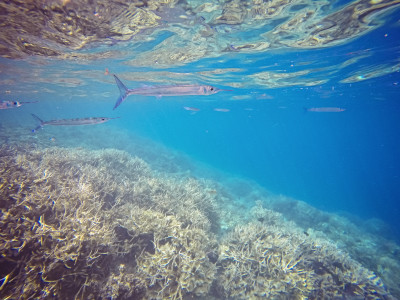
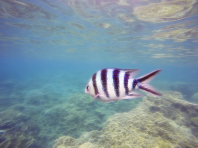
Ironwood Beach is on a tiny islet off Ngeruktabel’s eastern shore. Here we snorkeled three times, each in a different cardinal direction. We spotted turtles, a black-tip reef shark, a fair amount of live coral, and numerous reef fish of all sizes. We were constantly followed by schools of needle fish, along with a few larger, individual fish.
During our stay at Ironwood Beach, several tour boats dropped their passengers at the moorings on the islet’s windward, northeastern side. Other boats sought refuge on the island’s leeward, southwestern shore as a line of storm clouds passed. A private charter dropped its two passengers at the windward moorings, and then beached in the islet’s lee while the snorkelers slowly drifted around.
The second stop was Honeymoon Beach, on another tiny islet. The distance between Ironwood Beach and Honeymoon Beach is small, just some 200 meters; but the wind was strong and against us, making for a disproportionately difficult paddle. Once there, we ate lunch and waited for the wind to ease before snorkeling the island’s windward side. The wind never slacked, but we snorkeled anyway. The surface current was strong, making it impossible to stay in one place long enough to see anything in detail. We drifted with the current. What passed beneath us looked good, but not as good as Ironwood Beach.
Our paddle back to Ngchus was fast and easy. A strong, narrow current carried us from Honeymoon Beach, back to the southern end of Ngeruktabel Island. The current contrasted sharply with the surrounding water, looking like a fast river running through a flat lake.
We returned to Ngchus at 2:30 in the afternoon, where a private boat was anchored near the beach. A middle-aged Japanese man was illegally fishing from the boat. On shore, an older Japanese man was photographing a young Japanese woman posed on a picnic table. Their dinner was cooking in a fire pit.
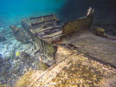
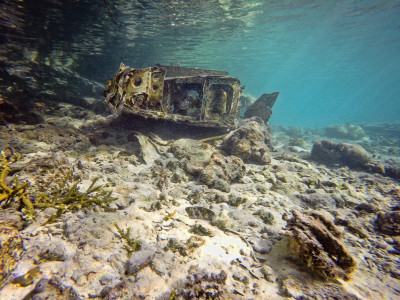
While they fished, posed, and ate; we paddled around the cove and found the sunken Japanese warplane. We snorkeled the plane, and then we snorkeled the lagoon, again finding a giant ball of bait fish.
After the Japanese boaters left, we set camp, ate, drank some coffee, and went to bed. A quick, light shower passed at 2:00 in the morning. Nuts fell onto the metal roof throughout the night, and we both wondered just how many nuts one tree can drop.
Day 5: Ulong Island
This day’s plan was to paddle from Ngchus to Ulong Island, explore Ulong, and camp there for the night.
We woke with the sun, ate, broke camp, packed the boat, and got on the water. Exiting Ngchus cove, we spotted a double rainbow to our south as seabirds circled the boat and struck the water around us. We stayed tight to the shores of Ngeruktabel and Ngededangel Islands, which kept us out of the wind and made for an easy paddle to Klo Toi Beach.
Klo Toi Beach is inside a small cove at the northern end of Ngededangel Island, directly across a one-nautical-mile-wide channel from Ulong. We stopped here to rest and have a snack before crossing. The amount of trash that wind, waves, and tide had pushed into the cove and onto the beach was disturbing. The “trash line” on the beach was truly that: a line of trash, heavy in plastic bottles and other junk.
The crossing from Klo Toi Beach to Ulong was painful. The northwesterly winds were amplified in the channel, and the waves were three feet and breaking. The seas were too much to take on the kayak’s beam without rolling, and running with them risked broaching. The only option was to point diagonally upwind, into the waves, slowly advancing northwest. This put us on the northern, windward, wrong side of Ulong as we cleared the channel. Here the wind and waves were still significant, but they gradually slackened enough to permit running with them into Ongalkereel, the lagoon that cuts through the middle of Ulong. We had made the error of starting to cross the channel too far upwind. We should have started farther downwind, so that pointing upwind would have brought us diagonally across the channel below Ulong and into its lee. We paid for the error with a hard, risky stretch of paddling.
Safely inside Ongalkereel, we paddled through it to Ulong’s southern shore. From there, we turned east to Turtle Cove for lunch. We saw no turtles in the cove, but the beach was nice.
A megayacht was anchored off Turtle Cove. As we cooked and ate, the yacht’s tender brought four young men and women to the beach. They began setting-up tables, chairs, and cooking equipment for the owner’s dinner. We tried talking with these four, but they were short and secretive in their communications, showing the arrogance-by-association that sometimes infects servants of the rich.
Leaving the four young servants in our wake, we paddled to Survivor Beach on Ulong’s western end. Survivor Beach and its waters were heavily windswept from the northwest. The final approach to the beach was hard paddling, and snorkeling was out of the question.
Three tour boats were anchored off the beach. Their Chinese passengers were ashore, eating lunch. While they dined, we walked to the ruins of an ancient village, constantly attacked by mosquitoes. A stone wall is about all that remains.
The tour boats were still on the beach when we returned, so we paddled back to the lagoon in Ulong’s center and tried a bit of snorkeling. The lagoon is beautiful, but the snorkeling is unimpressive.
Then it was back to Survivor Beach, where one tour boat and one Chinese family remained. Dan made the mistake of asking if they had any beer they wanted to sell. They did not, but that apparently obligated them to offer us nuts and pastries left over from their lunch, which we accepted with many thanks.
When this last tour boat left, we set camp, made coffee, ate dinner, and went to bed. Survivor Beach is a developed campsite, but it has no platforms, which forced us to tent on the ground. We were concerned about the rats we saw running through the campsite, but they did not bother us during the night. We slept well.
Our impression of Ulong is that it is not worth the effort. The paddle to and from the island is a chore without equivalent reward. If you do go, try camping on the beach in Turtle Cove. It had no tables, benches, or cook pits; but it was much nicer and more private than Survivor Beach.
Day 6: Ulong to Koror
Throughout our Rock Islands trip, locals asked how we were returning to Koror. When we told them our plan — to paddle there from Ulong, in a single day — it was consistently met with surprised looks. More than one local said that we “must be strong,” which seemed more sarcasm than compliment. The feedback was enough to make us re-examine our plan, but not enough to abandon it.
And now the day of execution had arrived. We woke before sunrise, broke camp, ate, packed the boat, and were paddling by 7:00 in the morning.
The paddle eastward along Ulong’s southern, lee shore was easy. It warmed our muscles for the struggle ahead.
The channel between Ulong and Ngebedangel was windy and choppy, but not as bad as the day before. We stayed pointed up, into the northwesterly winds and waves, while making good on an easterly course to Ngebedangel’s western shore. Once there, we turned south toward Little Channel, paddling fast and easy in the calm waters that ran tight to the island’s shore.
Little Channel was windy and choppy, but not as bad as our first passing, four days earlier. We were through without much difficulty.
Now began the hardest part of the day’s paddling. From Little Channel to The Pincers, we alternated between windswept, open waters and the calm found in the undercuts of shorelines. Our general line ran from Little Channel, east to the western shore of Ngeruktabel, and then tight along that shore to The Pincers. The worst stretches were Little Channel to Fish Bowl, and Peninsula Camp to The Pincers.
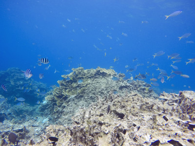
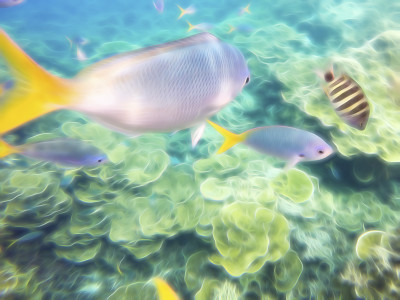
Along the way, we stopped to snorkel at Fish Bowl. This was the best snorkeling spot we encountered in Palau. The coral was fantastic, as was the vast array of fish.
After a final, hard slog to the northwestern tip of Ngeruktabel Island, we entered The Pincers. We expected the channel to be windy and rough, but it was not. We crossed easily, continued to Malakal Island in fairly calm waters, and reached Sam’s Tours at 3:30 in the afternoon. It had been eighteen nautical miles and eight-and-a-half hours of hard work.
Jake the tour guide was waiting for us. He helped us unload the boat, gave us a ride to our accommodations at Caroline’s, and stopped for beer along the way.
We were dead tired. Once settled in our bungalow, we laid out the wet gear, drank beer, ate a delivery pizza, and slept.
Kayaking Tips
Most of the Rock Islands have been undercut by the ocean, creating half-tunnels along otherwise vertical shorelines. These half-tunnels are usually large enough to paddle in, with a rock wall on one side, open water on the other, a rock ceiling above, and an underwater rock shelf below. Many of the underwater shelves are waist-deep or shallower, making them useful for entering and exiting a kayak.
The wind and water can be much calmer in the undercuts than just a few meters seaward. Hug the land and paddle inside the undercuts as much as possible.
Some areas have no sand beaches, giving the impression that you are doomed to paddle for miles without a break. Look a little harder, though, and you will see the underwater ledges and frequent caves with water-level entrances. Both of these offer opportunities to get out of the boat.
You still need to know deep water reentry techniques. This allows you to get in and out of the boat when you stumble across a great snorkeling spot in deep water. We rigged rope steps to the side of our kayak, which aided with reentry.
Touristed snorkeling spots can be spotted by looking for mooring buoys and “no fishing” signs.
Tour boats use the developed camp sites as lunch spots. Staying in camp during the day means sacrificing your privacy.

